groups alphabetical name index Brown Cooke Dawson Dix Hancock Hayward High Holman Lynn Pigott Woodhouse
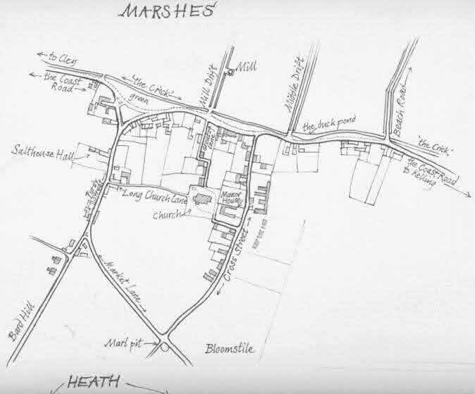
village sketchmap with hotspots
(that's where you are now!)
old
maps
channel map readable- replica
map of fields
aerial views
from a plane
from church tower
old postcard views on village map (that's where we are now!)
click here to go to Salthouse village map
at Multimap.com
rest your cursor on an eye to open it and then click to see the view from that spot!
have a look at an overhead photo of this same view of the village!
See the view from different points![]()
|
© Val Fiddian 2005